2 photos
- LanguageAfrikaans Argentina Azərbaycanca
Bahasa Indonesia Brasil Brezhoneg
Català Česky Dansk
Deutsch Dhivehi English
English English Español
Esperanto Estonian Euskara
Finnish Français Français
Gaeilge Galego Hrvatski
Íslenska Italiano Latviešu
Lëtzebuergesch Lietuviu Magyar
Malay México Nederlands
Norsk bokmål Norwegian nynorsk Polski
Português Română Slovenšcina
Slovensky Srpski Svenska
Tiếng Việt Türkçe Wolof
Ελληνικά Български Македонски
Монгол Русский Српски
Українська עברית العربية (مصر)
العربية العربية پارسی
कोंकणी বাংলাગુજરાતી
தமிழ் ಕನ್ನಡ ภาษาไทย
ქართული ខ្មែរ 中文 (繁體)
中文 (香港) 日本語 简体中文
한국어
Home / Algeria 37
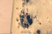
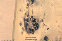
Someone formed The landscape into three colossal geoglyph hands with fingers pointing. One finger is approximately 1000 meters by 2000 meters.

-
hand 3
2 photos


![English [US] English [US]](language/en_US/en_US.jpg)
![Afrikaans [ZA] Afrikaans [ZA]](language/af_ZA/af_ZA.jpg)
![Argentina [AR] Argentina [AR]](language/es_AR/es_AR.jpg)
![Azərbaycanca [AZ] Azərbaycanca [AZ]](language/az_AZ/az_AZ.jpg)
![Bahasa Indonesia [ID] Bahasa Indonesia [ID]](language/id_ID/id_ID.jpg)
![Brasil [BR] Brasil [BR]](language/pt_BR/pt_BR.jpg)
![Brezhoneg [FR] Brezhoneg [FR]](language/br_FR/br_FR.jpg)
![Català [CA] Català [CA]](language/ca_ES/ca_ES.jpg)
![Česky [CZ] Česky [CZ]](language/cs_CZ/cs_CZ.jpg)
![Dansk [DK] Dansk [DK]](language/da_DK/da_DK.jpg)
![Deutsch [DE] Deutsch [DE]](language/de_DE/de_DE.jpg)
![Dhivehi [MV] Dhivehi [MV]](language/dv_MV/dv_MV.jpg)
![English [GB] English [GB]](language/en_GB/en_GB.jpg)
![English [UK] English [UK]](language/en_UK/en_UK.jpg)
![Español [ES] Español [ES]](language/es_ES/es_ES.jpg)
![Esperanto [EO] Esperanto [EO]](language/eo_EO/eo_EO.jpg)
![Estonian [EE] Estonian [EE]](language/et_EE/et_EE.jpg)
![Euskara [ES] Euskara [ES]](language/eu_ES/eu_ES.jpg)
![Finnish [FI] Finnish [FI]](language/fi_FI/fi_FI.jpg)
![Français [FR] Français [FR]](language/fr_FR/fr_FR.jpg)
![Français [QC] Français [QC]](language/fr_CA/fr_CA.jpg)
![Gaeilge [IE] Gaeilge [IE]](language/ga_IE/ga_IE.jpg)
![Galego [ES] Galego [ES]](language/gl_ES/gl_ES.jpg)
![Hrvatski [HR] Hrvatski [HR]](language/hr_HR/hr_HR.jpg)
![Íslenska [IS] Íslenska [IS]](language/is_IS/is_IS.jpg)
![Italiano [IT] Italiano [IT]](language/it_IT/it_IT.jpg)
![Latviešu [LV] Latviešu [LV]](language/lv_LV/lv_LV.jpg)
![Lëtzebuergesch [LU] Lëtzebuergesch [LU]](language/lb_LU/lb_LU.jpg)
![Lietuviu [LT] Lietuviu [LT]](language/lt_LT/lt_LT.jpg)
![Magyar [HU] Magyar [HU]](language/hu_HU/hu_HU.jpg)
![Malay [MY] Malay [MY]](language/ms_MY/ms_MY.jpg)
![México [MX] México [MX]](language/es_MX/es_MX.jpg)
![Nederlands [NL] Nederlands [NL]](language/nl_NL/nl_NL.jpg)
![Norsk Bokmål [NO] Norsk Bokmål [NO]](language/nb_NO/nb_NO.jpg)
![Norwegian Nynorsk [NO] Norwegian Nynorsk [NO]](language/nn_NO/nn_NO.jpg)
![Polski [PL] Polski [PL]](language/pl_PL/pl_PL.jpg)
![Português [PT] Português [PT]](language/pt_PT/pt_PT.jpg)
![Română [RO] Română [RO]](language/ro_RO/ro_RO.jpg)
![Slovenšcina [SI] Slovenšcina [SI]](language/sl_SI/sl_SI.jpg)
![Slovensky [SK] Slovensky [SK]](language/sk_SK/sk_SK.jpg)
![Srpski [SR] Srpski [SR]](language/sh_RS/sh_RS.jpg)
![Svenska [SE] Svenska [SE]](language/sv_SE/sv_SE.jpg)
![Tiếng Việt [VN] Tiếng Việt [VN]](language/vi_VN/vi_VN.jpg)
![Türkçe [TR] Türkçe [TR]](language/tr_TR/tr_TR.jpg)
![Wolof [SN] Wolof [SN]](language/wo_SN/wo_SN.jpg)
![Ελληνικά [GR] Ελληνικά [GR]](language/el_GR/el_GR.jpg)
![Български [BG] Български [BG]](language/bg_BG/bg_BG.jpg)
![Македонски [MK] Македонски [MK]](language/mk_MK/mk_MK.jpg)
![Монгол [MN] Монгол [MN]](language/mn_MN/mn_MN.jpg)
![Русский [RU] Русский [RU]](language/ru_RU/ru_RU.jpg)
![Српски [SR] Српски [SR]](language/sr_RS/sr_RS.jpg)
![Українська [UA] Українська [UA]](language/uk_UA/uk_UA.jpg)
![עברית [IL] עברית [IL]](language/he_IL/he_IL.jpg)
![العربية (مصر) [EG] العربية (مصر) [EG]](language/ar_EG/ar_EG.jpg)
![العربية [AR] العربية [AR]](language/ar_SA/ar_SA.jpg)
![العربية [MA] العربية [MA]](language/ar_MA/ar_MA.jpg)
![پارسی [IR] پارسی [IR]](language/fa_IR/fa_IR.jpg)
![कोंकणी [IN] कोंकणी [IN]](language/kok_IN/kok_IN.jpg)
![বাংলা[IN] বাংলা[IN]](language/bn_IN/bn_IN.jpg)
![ગુજરાતી[IN] ગુજરાતી[IN]](language/gu_IN/gu_IN.jpg)
![தமிழ் [IN] தமிழ் [IN]](language/ta_IN/ta_IN.jpg)
![ಕನ್ನಡ [IN] ಕನ್ನಡ [IN]](language/kn_IN/kn_IN.jpg)
![ภาษาไทย [TH] ภาษาไทย [TH]](language/th_TH/th_TH.jpg)
![ქართული [GE] ქართული [GE]](language/ka_GE/ka_GE.jpg)
![ខ្មែរ [KH] ខ្មែរ [KH]](language/km_KH/km_KH.jpg)
![中文 (繁體) [TW] 中文 (繁體) [TW]](language/zh_TW/zh_TW.jpg)
![中文 (香港) [HK] 中文 (香港) [HK]](language/zh_HK/zh_HK.jpg)
![日本語 [JP] 日本語 [JP]](language/ja_JP/ja_JP.jpg)
![简体中文 [CN] 简体中文 [CN]](language/zh_CN/zh_CN.jpg)
![한국어 [KR] 한국어 [KR]](language/ko_KR/ko_KR.jpg)


